
Snow and Ice Water Resources and Hazards
Correcting precipitation data, monitoring surface elevation changes, assessing snowmelt contributions and improving runoff simulations in anomalous years.

Precipitation Correction and Gridded Data
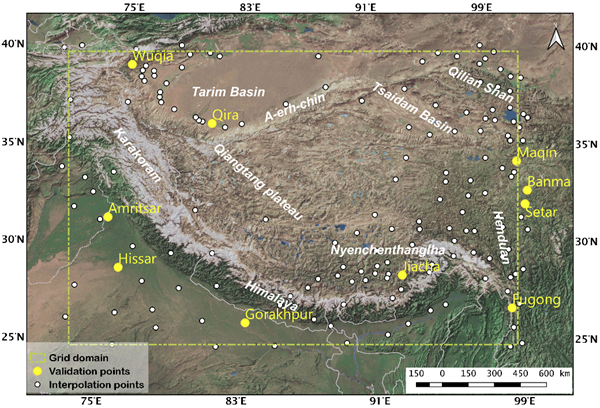
We analyse precipitation measurement losses at high elevations and under strong winds. Combining wind-speed correction with constraints on precipitation frequency distributions, we produced daily gridded precipitation for the Tibetan Plateau for 1980–2009 at 10 km resolution. Subsequent work uses machine learning to correct high-elevation precipitation measurements and evaluates satellite and reanalysis precipitation products in cold and arid mountains.
Runoff Simulation in Anomalous Years
Using the Heihe River basin as a case study, we apply continuous and cross-wavelet analyses to identify anomalous periods in meteorological and runoff time series. These periods inform the selection of training samples for machine-learning models, whose performance is then evaluated under anomalous hydrological conditions. The method was published in Journal of Hydrology (2025). Read about the research →
Research on snowmelt contributions includes changes in spring snowmelt in the source region of the Yangtze River and elevation-dependent differences in the central Tibetan Plateau. These process studies connect to the Snow Hydrology research topic and help explain runoff sources across regions and periods.
Satellite Altimetry and Surface Change
We used ICESat-2 crossovers to construct a high-spatial-resolution elevation-change dataset for the Tibetan Plateau for 2018–2022. The dataset is provided in CSV and SHP formats and was validated against observations and existing products for glaciers, lakes and other surfaces. The data paper was published in Scientific Data (2024). Read about the research →
Lake Water Resources and Ecological Water Replenishment
In the Baiyangdian lake region, we combine ICESat-series altimetry, Sentinel-2 imagery, surface-water data and water-replenishment records to analyse changes in lake water levels, area and connectivity. The results were published in Environmental Research Communications (2023). Read about the research →
Recent publications
All 23 publications and citations →Abrupt shift in elevation-dependent snowmelt contribution in the Central Tibetan Plateau
Full citation
Zixiang Li, Hongyi Li, Weixin Xu, Yaru Yang, Rui He, Yiwei Liu, Yuanbao Feng, Na Dai. (2026). Abrupt shift in elevation-dependent snowmelt contribution in the Central Tibetan Plateau. Journal of Hydrology: Regional Studies, 66, 103634. https://doi.org/10.1016/j.ejrh.2026.103634
Enhancing machine learning runoff simulation via wavelet-based abnormality pattern recognition
Full citation
Yiwei Liu, Hongyi Li, Yaru Yang, Xin Pang, Liting Niu. (2025). Enhancing machine learning runoff simulation via wavelet-based abnormality pattern recognition. Journal of Hydrology, 661, 133729. https://doi.org/10.1016/j.jhydrol.2025.133729
Runoff contribution of spring snowmelt in the source region of the Yangtze River and its variation characteristics
Full citation
Zixiang Li, Weixin Xu, Hongyi Li, Na Dai, Kunlin Huang, Yaru Yang, Lidong Li, Jingke Si. (2025). Runoff contribution of spring snowmelt in the source region of the Yangtze River and its variation characteristics. Journal of Hydrology: Regional Studies, 58, 102295. https://doi.org/10.1016/j.ejrh.2025.102295
Assessing satellite and reanalysis-based precipitation products in cold and arid mountainous regions
Full citation
Yang Yaru, Ji Wenzheng, Niu Liting, Zheng Zhaojun, Huang Weidong, Zhang Changshun, Hao Xiaohua, Xiao Jianshe, Li Hongyi. (2024). Assessing satellite and reanalysis-based precipitation products in cold and arid mountainous regions. Journal of Hydrology: Regional Studies, 51, 101612. https://doi.org/10.1016/j.ejrh.2023.101612
Monitoring Cold-Region Water Cycles Using Remote Sensing Big Data
Full citation
Li, Hongyi, Hao, Xiaohua, Ran, Youhua, Xiao, Pengfeng. (2024). Monitoring Cold-Region Water Cycles Using Remote Sensing Big Data. Remote Sensing, 16(24), 4752. https://doi.org/10.3390/rs16244752
High spatial resolution elevation change dataset derived from ICESat-2 crossover points on the Tibetan Plateau
Full citation
Tengfei Chen, Jian Wang, Tao Che, Xiaohua Hao, Hongyi Li. (2024). High spatial resolution elevation change dataset derived from ICESat-2 crossover points on the Tibetan Plateau. Scientific Data, 11, 394. https://doi.org/10.1038/s41597-024-03214-2
Related news
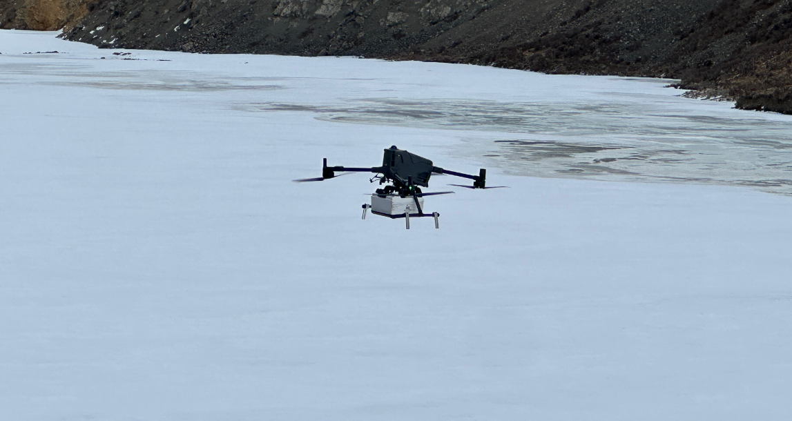
River Ice Field Observations in the Babao River Basin, Qilian Mountains
From March 9 to 16, 2026, the team collected river-ice samples, measured ice thickness, and conducted UAV ground-penetrating radar surveys in the Babao River …
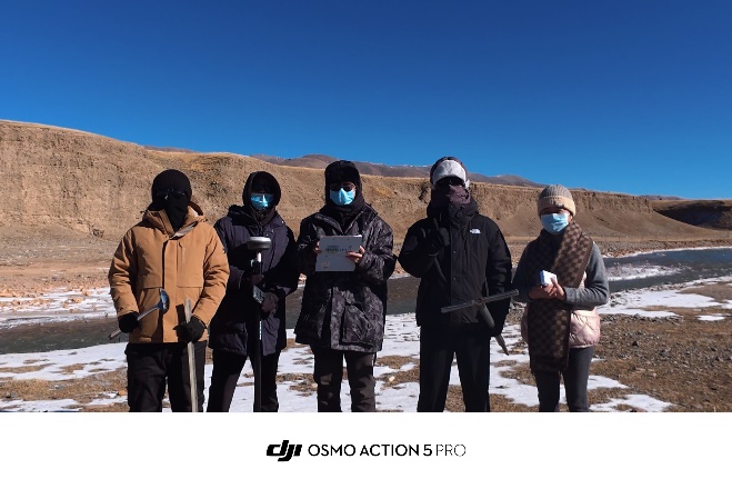
Annual Snow and Ice Survey of Hexi Inland Rivers Completed
From November 25 to December 1, 2025, supported by a key project of the National Natural Science Foundation of China’s Regional Joint Fund, the research …
Yiwei Liu Awarded the 2025 National Scholarship
Yiwei Liu, a master’s student who joined the team in 2023, recently received the 2025 National Scholarship for Master’s Students. Yiwei Liu studies …
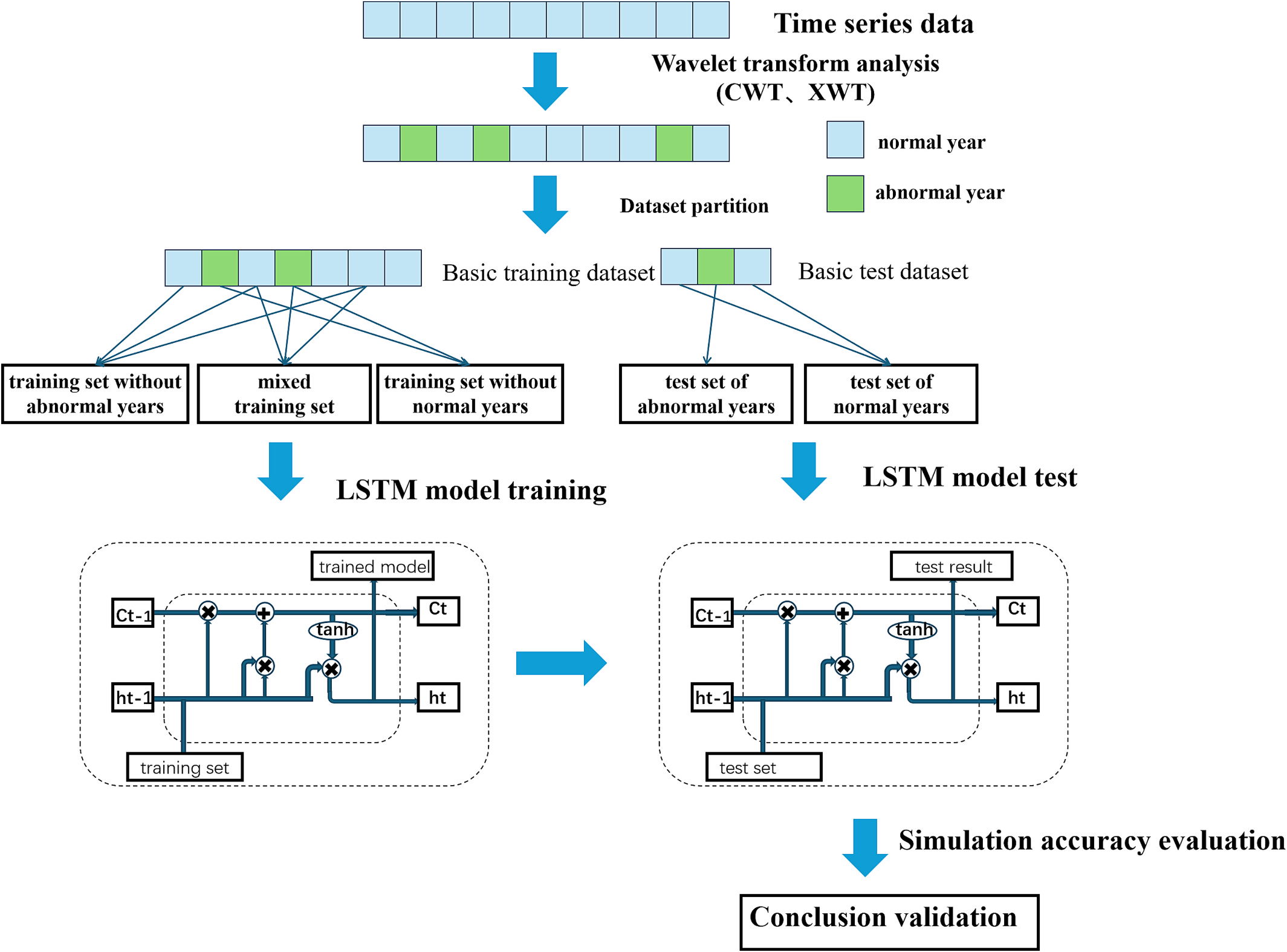
Improving Machine Learning Runoff Simulation under Extreme Hydrological Conditions with Wavelet-Based Abnormality Recognition
As extreme climatic and hydrological events become more frequent, improving the performance of data-driven hydrological models under anomalous conditions has …

Team Morning Run
The team enjoyed a morning run together along the Yellow River greenway, taking in a beautiful summer morning. Team group photograph during the morning run
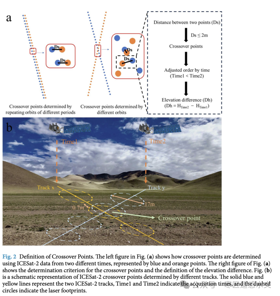
ICESat-2 Elevation Change Dataset for the Tibetan Plateau Published in Scientific Data
Figure 1: Schematic of the method for identifying ICESat-2 crossover point distributions on the Tibetan Plateau Understanding surface elevation changes on the …