ICESat-2 Elevation Change Dataset for the Tibetan Plateau Published in Scientific Data
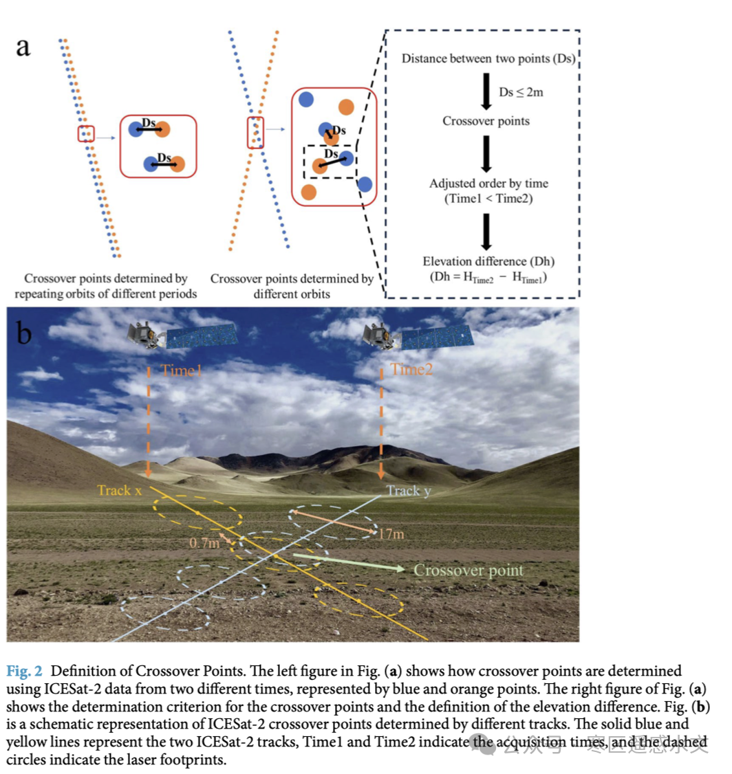
Understanding surface elevation changes on the Tibetan Plateau is essential for understanding the evolution of its topography, landscapes, climate, environmental conditions, and water resources. Existing elevation change products, however, either cover only specific surface types or limited regions, or have relatively coarse spatial resolution. The research team therefore extracted crossover points from ICESat-2 satellite observations and constructed an elevation change dataset for the Tibetan Plateau for 2018–2022.
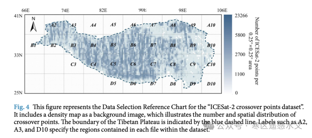
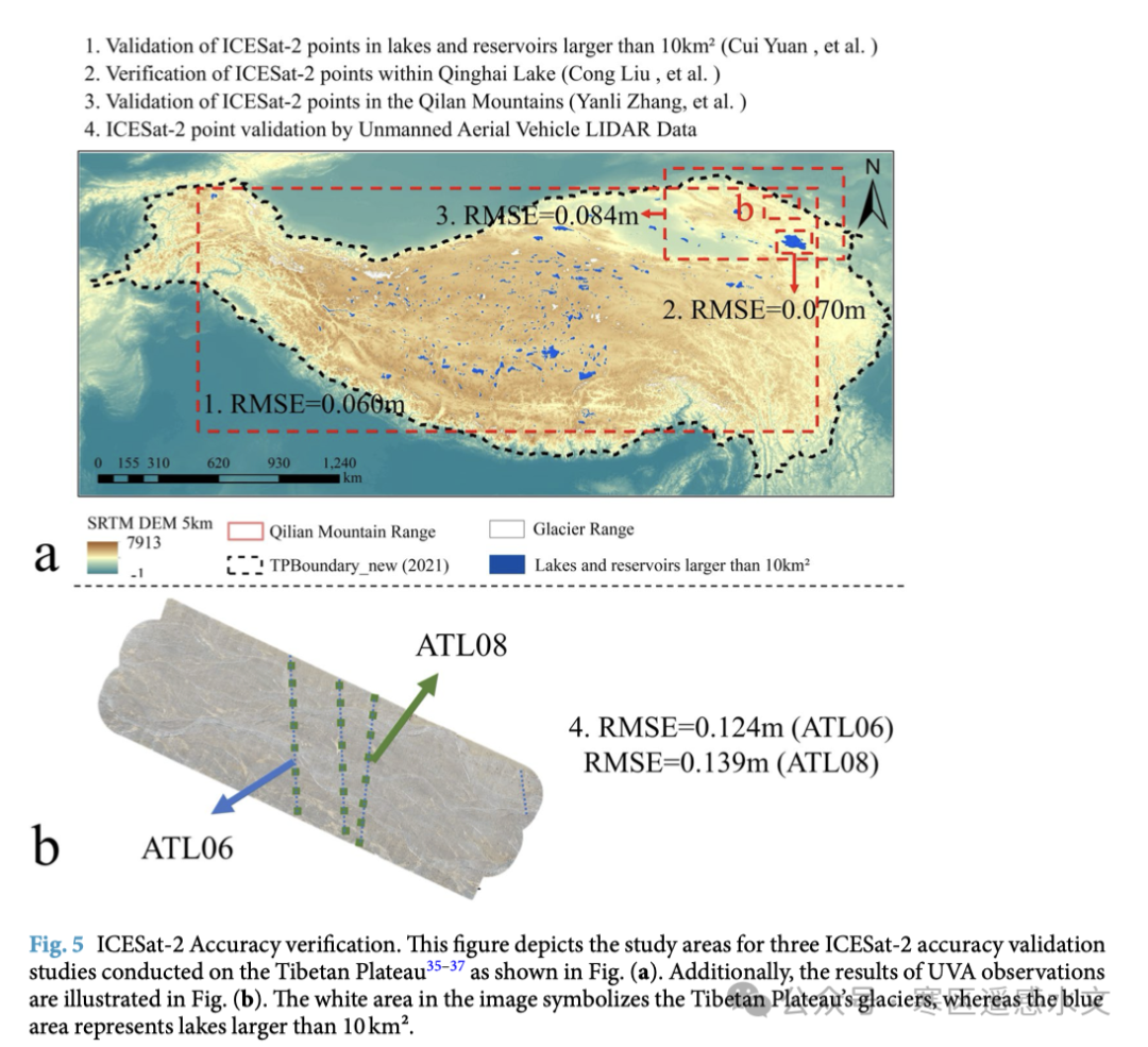
The dataset has a crossover density of 2.015 pairs/km². Each crossover pair represents the elevation difference between two observation periods within an area approximately 17 m in diameter. By comparing ICESat-2 crossover data with existing results for glaciers, lakes, and other surfaces, the team validated the reliability of the inferred elevation changes using lake gauges, continuously operating reference stations (CORS), UAV LiDAR, and published ICESat-2 error assessments. The results show a single-point elevation root mean square error (RMSE) of approximately 0.071 m, corresponding to an elevation-difference RMSE of 0.13 m per crossover pair, maintaining sub-decimeter elevation accuracy even over the plateau’s complex terrain.
Data Validation
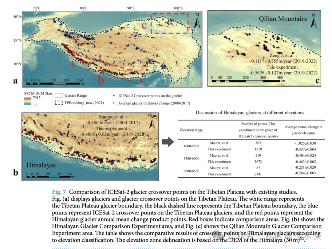
The paper further cross-validated the crossover data against existing glacier and lake change products. Within the area covered by the 2000–2017 Himalayan glacier thickness change dataset, the difference in mean annual change rates between the two datasets was only 0.008 ± 0.002 m/year. For six representative glaciers in the Qilian Mountains, annual rates inferred from the crossover points also fell within the uncertainty ranges of previous studies. For lakes, comparisons across 11 time intervals at six lakes, including Sugan Lake, Siling Co, and Nam Co, yielded a correlation coefficient of 0.85 and an RMSE of 0.17 m between the crossover method and multisatellite lake-level data. Lake-ice cover did not significantly reduce accuracy.
Potential Applications
The team expects the fine-scale, plateau-wide elevation-difference data to provide key calibration points for permafrost monitoring, coupled glacier–hydrology modeling, lake water storage assessment, and even machine learning models of surface evolution. For example, multitemporal crossover points along the Qinghai–Tibet Railway could help track active-layer subsidence and identify potential embankment risks early. In mountain catchments, crossover time series can help fill gaps in information about changes within small glaciers and improve the reliability of meltwater runoff forecasts.
ICESat-2 crossover data provide a finer source of information for high-spatial-resolution studies of surface elevation change. The dataset, in CSV and SHP formats, and all processing scripts have been released openly through the National Tibetan Plateau Data Center and GitHub, with continuing updates planned as new satellite cycles become available.
Publication
Chen, T., Wang, J., Che, T., Hao, X., & Li, H*. (2024). High spatial resolution elevation change dataset derived from ICESat-2 crossover points on the Tibetan Plateau. Scientific Data, 11(1), 394. https://doi.org/10.1038/s41597-024-03214-2
Data Download
Chen, Tengfei, Li, Hongyi, Wang, Jian. (2023). High spatial resolution elevation change dataset derived from ICESat-2 crossover points for the Tibetan Plateau (2018–2022) (V2.0). National Tibetan Plateau Data Center. https://doi.org/10.11888/RemoteSen.tpdc.300749
Chen, T., Li, H., Wang, J. (2023). High spatial resolution elevation change dataset derived from ICESat-2 crossover points for the Tibetan Plateau (2018-2022)(V2.0). National Tibetan Plateau / Third Pole Environment Data Center. https://doi.org/10.11888/RemoteSen.tpdc.300749
View dataset details and other data shared by the team →