Distinguishing Mountain-Scale Blowing Snow through Remote Sensing
Wind plays a crucial role in snow redistribution, particularly in shaping the spatial and temporal distribution of snow in high-elevation mountains. Numerous studies have examined relationships between wind and snow distribution, but most have focused on blowing-snow mechanisms and small-scale redistribution, relying exclusively on meteorological observations. Few have used remote sensing to analyze wind effects on snow distribution across large mountain catchments.
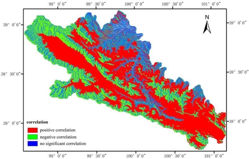
To address this gap, the Cold-Region Remote Sensing Hydrology group at the Northwest Institute of Eco-Environment and Resources, Chinese Academy of Sciences, combined remote sensing with wind fields from the Weather Research and Forecasting (WRF) model to investigate wind effects at larger scales. The study focused on the Qilian Mountains in the northeastern Tibetan Plateau, using MODIS snow products and a WRF atmospheric forcing dataset for the catchment. The results identified an important elevation threshold in the relationship between snow cover fraction and wind speed: above 3,900 m, the correlation was significantly negative, whereas below 3,900 m it was significantly positive. Blowing snow was more likely above 3,900 m, where wind transported snow to lower elevations. This work provides a distinctive approach to understanding wind effects on mountain snow distribution using remote sensing. It was the first international study to investigate mountain snow redistribution using optical remote sensing and can support monitoring and understanding of snow redistribution processes at mountain scales.
The findings were published in IEEE-JSTARS. See:
Shao, D.; Li, H.; Wang, J.; Pan, X.; Hao, X. Distinguishing the role of wind in snow distribution by utilizing remote sensing and modeling data: Case study in the northeastern Tibetan Plateau. IEEE Journal of Selected Topics in Applied Earth Observations & Remote Sensing 2017, PP, 1–12.