
Downscaled Snow Depth Product from Passive Microwave and Optical Remote Sensing
Xiaohua Hao’s research team proposed a downscaled snow depth retrieval algorithm that couples deep learning with a snow microwave radiative transfer model, using passive microwave and optical remote sensing data. The method produced daily snow depth at 500 m resolution for northern Xinjiang from 2012 to 2020. Existing snow depth data with high temporal resolution are generally derived from passive microwave observations, whose coarse spatial resolution cannot meet the needs of regional hydrology and hazard studies. The study used deep learning to map complex nonlinear relationships between snow depth and features such as AMSR 2 brightness temperature differences, snow-covered days, and fractional snow cover. A coupled snow microwave radiative transfer model fitted effective snow grain size, and a snow depletion curve method supported downscaling to 500 m. Overall RMSE and MAE were 6.51 cm and 4.64 cm, respectively, substantially better than AMSR 2 (RMSE 26.14 cm; MAE 19.06 cm), ERA5-Land (RMSE 17.67 cm; MAE 13.76 cm), and the spatially dynamic downscaled snow depth product SSDDsd (RMSE 16.59 cm; MAE 12.20 cm). The new product also resolves finer spatial patterns of snow depth, particularly snow heterogeneity in complex mountains.
Figure 1 shows the study area and meteorological stations. Figure 2 compares validation accuracy for the retrieved FSSDsd snow depth against AMSR 2, ERA5-Land, and SSDDsd. Focusing on parts of the Tianshan Mountains and Junggar Basin in southern portions of northern Xinjiang, Figure 3 shows the spatial distributions of AMSR 2, ERA5-Land, SSDDsd, and FSSDsd for December 1, 2017, and January 1, 2018.
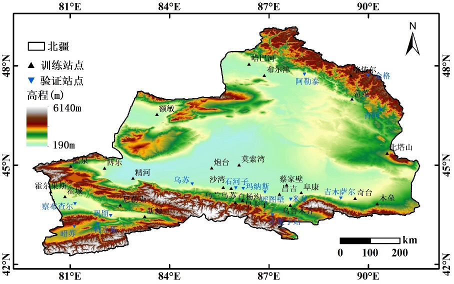
Figure 1. Study area and spatial distribution of meteorological stations

Figure 2. Comparison of snow depth validation accuracy for AMSR 2, ERA5-Land, SDDsd, and FSSDsd